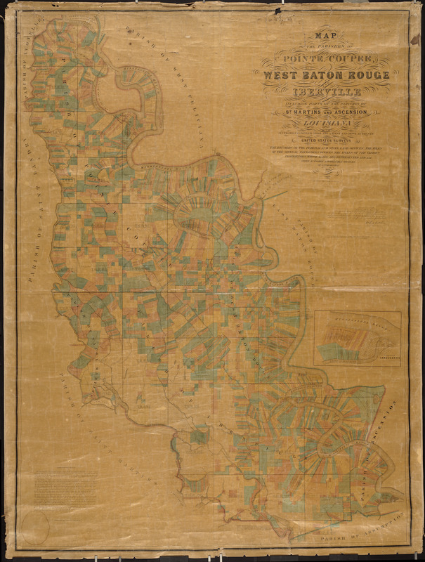
Map of the parishes of Pointe Coupee, West Baton Rouge and Iberville
Powell, Andrew J. · 1858
Louisiana’s sugar and cotton plantations are shown in Louisiana’s sugar and cotton plantations are shown in great detail on this landownership map of Baton Rouge and surrounding parishes. The long linear properties, reflecting the original French and Spanish settlement of the area, line the meanders of the Mississippi River. By 1860, Louisiana had roughly 1,300 sugar plantations, with the properties delineated on this map accounting for nearly 25 % of the state’s sugar production. Because of superior agricultural and manufacturing capabilities, Louisiana had an edge over Caribbean competitors and controlled nearly 60% of the U. S. market. Sugar production, like textile manufacturing, required large amounts of capital investment. Louisiana was at the northern edge of sugar-growing latitudes, and variable weather affected yearly production. As a result, many partnerships were established to spread risk, as suggested by multiple landowners’ names on the map.
Sign in to order prints, canvas, and more of this work. Browsing and full-resolution downloads stay free.