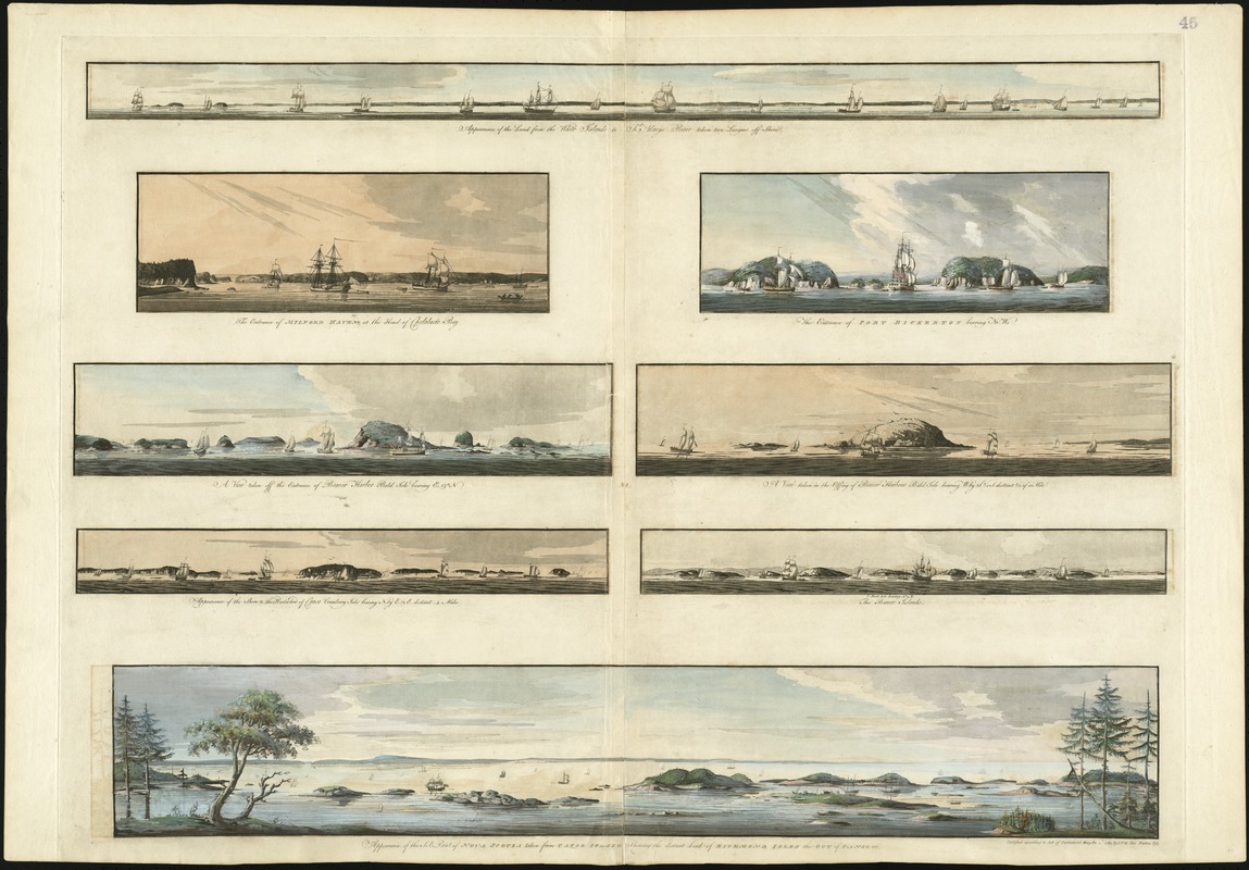
Appearance of the land from the White Islands to St. Marys River taken two leagues off shore
Des Barres, Joseph F. W. (Joseph Frederick Wallet), 1722-1824 · 1781
This grouping of eight headland views paints a striking picture of the Nova Scotia coast, east of Halifax. Covering a geographic area from Beaver Harbour northeast to Milford Haven (a distance of 160 miles), these coastal profiles served a utilitarian purpose for mariners navigating the complicated Nova Scotia coastline. Artistic elements such as foreboding skies and ships mooring in the port were added for aesthetic appeal; however, the coastal representations themselves were provided for navigational purposes. These views are a major advance over the earlier, unsophisticated headland views available to navigators in such works as the English Pilot.
Sign in to order prints, canvas, and more of this work. Browsing and full-resolution downloads stay free.