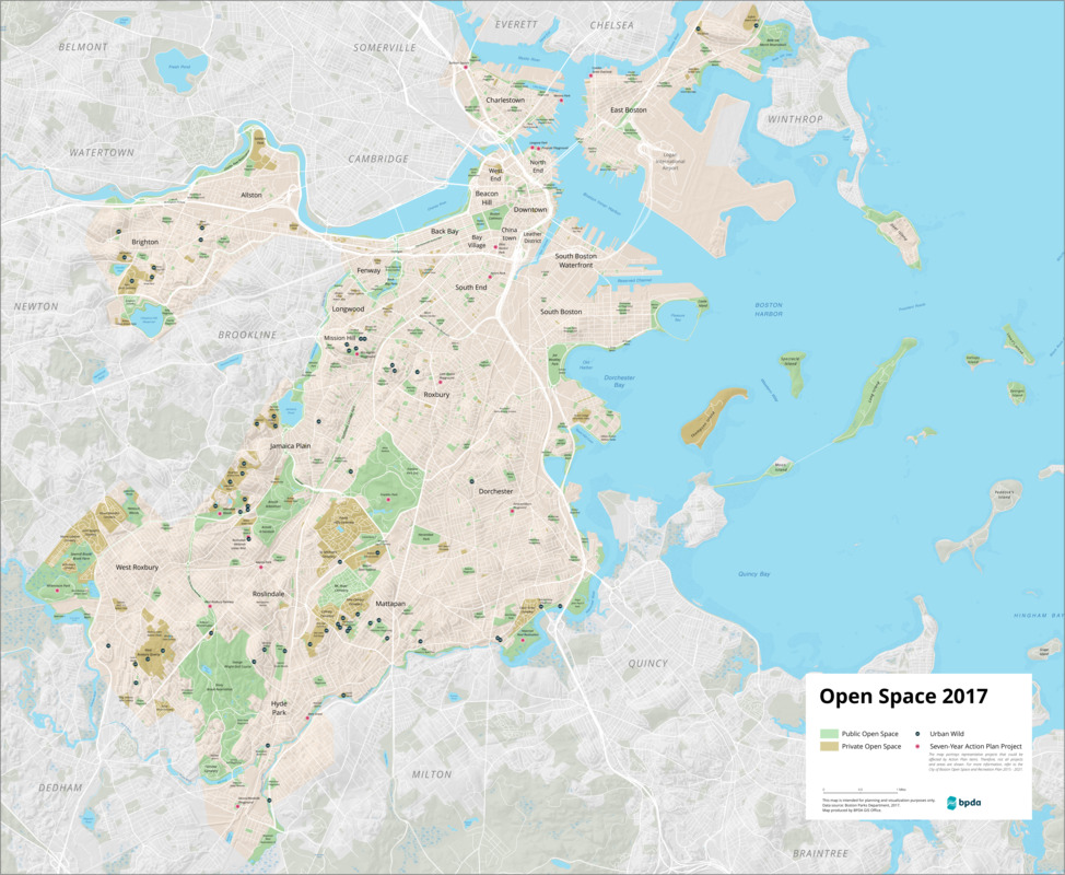
Open space 2017
Boston Planning and Development Agency · 2017
This map outlines public and private open spaces in Boston, as well as urban wilds, remnants of the original ecosystem that continue to flourish in pockets of the city. These wild areas are home to native plants and animals, and perform ecological services like retaining floodwater, producing oxygen, and filtering stormwater run-off. The map also features "Action Plan" items from the City of Boston's "Open Space and Recreation Plan 2015-2012." Action items include developing new parks in neighborhoods like Brighton and Mattapan, improving natural habitats such as the Muddy River, maintaining public art and memorials, increasing tree canopy coverage throughout the city, and more.
Sign in to order prints, canvas, and more of this work. Browsing and full-resolution downloads stay free.