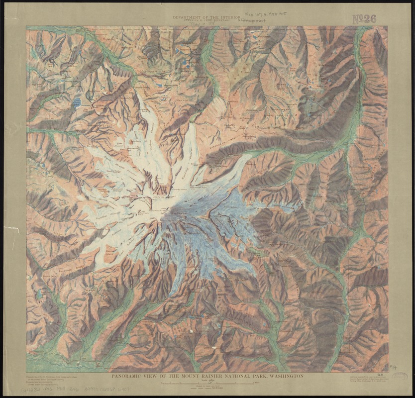
Panoramic view of the Mount Rainier National Park, Washington
Renshawe, John H. · [1914]
Regions and Seasons: Snowfall is another component of precipitation data found on weather maps, and is critical to a location’s resistance to drought during warm months. Mount Rainier, a national park, is an active volcano and the most glaciated peak in the lower forty-eight states. The Washington state mount was illustrated by topographer John Renshawe in 1914 during his work for the U.S. Geological Survey. Renshawe has applied color in a painterly manner to indicate relief, making this map look more like a work of art than a typical topographic map which used contour lines and minimal color to indicate relief.
Sign in to order prints, canvas, and more of this work. Browsing and full-resolution downloads stay free.