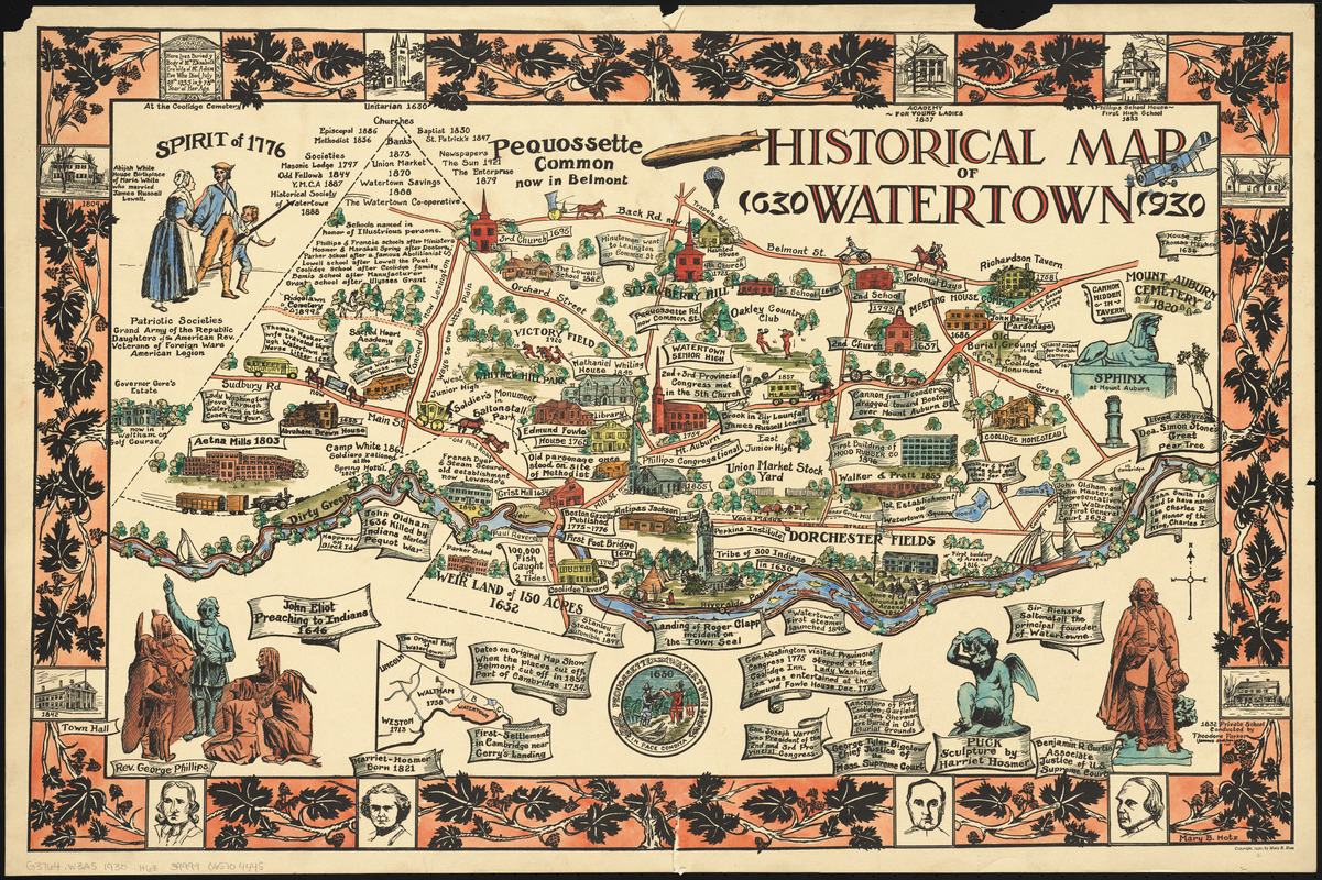
Historical map of Watertown, 1630-1930
Hotz, Mary B. · 1930
Mary Hotz designed this map as a high school student in 1930, for a poster contest celebrating the 300th anniversary of Watertown, Massachusetts. Her map of historical Watertown, complete with Native Americans, houses, churches, arsenals, courthouses, taverns, mills, schools and statues was the winning entry. Hotz combined recent and past history in this colorful and detailed map, which she shared with local community clubs, and President Calvin Coolidge, who had family ties to the town. She eventually attended art school in Boston, but never practiced professionally; however, her map appeared for years in official buildings and private residences throughout Watertown.
Sign in to order prints, canvas, and more of this work. Browsing and full-resolution downloads stay free.