Digital Commonwealth — Boston Public Library
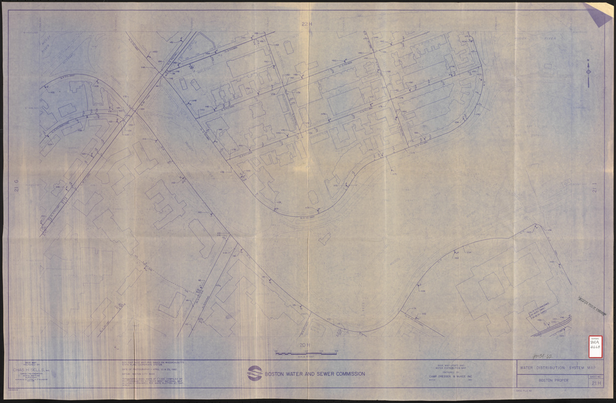
Water distribution system map, Boston proper, sheet no. 21h
Camp, Dresser & McKee · 1986
Map of a portion of Boston's Fenway (Simmon's College, Gardner Museum, Emmanual College, Museum of Fine Arts, Peterborough and Queensberry Street, Park Drive, Muddy River, Back Bay Fens Park area) showing the locations of water mains on a base map prepared by Chas. H. Sells, Inc. Includes footprints of buildings, names of prominent structures, etc.
🔒
Order museum-quality prints
Sign in to order prints, canvas, and more of this work. Browsing and full-resolution downloads stay free.