Digital Commonwealth — Williams College
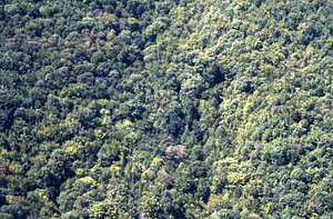
Aerial false color IR image of south boundary of The Hopkins Memorial Forest west of Northwest Hill Road. False Color Infrared/True Color Project.
Art, Henry Warren (Photographer) · September 1, 1974
Aerial false color IR image of south boundary of The Hopkins Memorial Forest west of Northwest Hill Road. Hedgerow down the center, USFS genetic plantations on left, old William T. Floyd Farm on right. Image taken west of image 19740901_0065. False Color Infrared/True Color Project. View to east.
🔒
Order museum-quality prints
Sign in to order prints, canvas, and more of this work. Browsing and full-resolution downloads stay free.