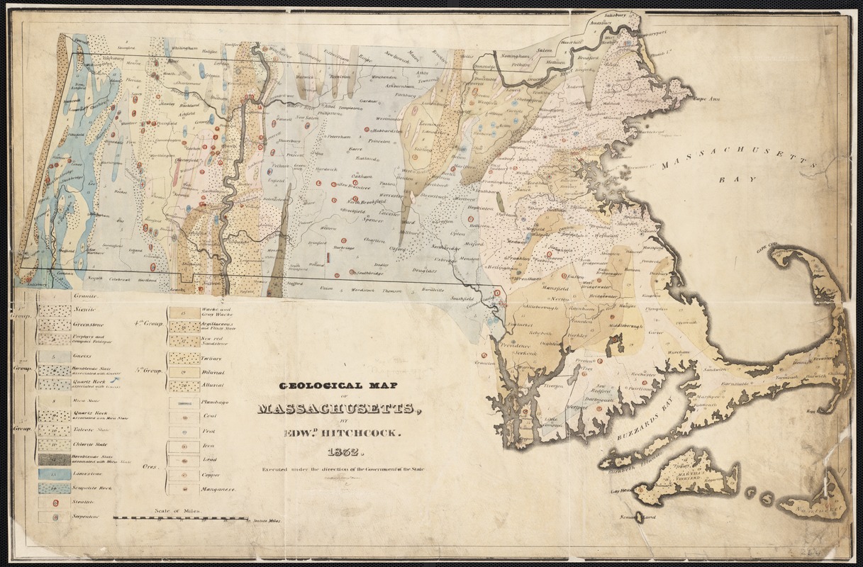
Geological map of Massachusetts
Hitchcock, Edward, 1793-1864 · [1832]
By the 1830s and 1840s, numerous eastern states throughout the country had established formal geological surveys to investigate their mineral resources. Edward Hitchcock became Massachusetts’ first state geologist in 1830, and two years later produced this map while serving in that role. Hitchcock not only used color to differentiate between rock formations and minerals, but also used symbols within major rock groups to illustrate finer levels of detail. Hitchcock taught natural sciences at Amherst College, and focused much of his research on the Connecticut River Valley, as evidenced by the thorough execution of geologic information in that area on the map.
Sign in to order prints, canvas, and more of this work. Browsing and full-resolution downloads stay free.